Cities and Communities

Cities and Communities

Tongji University 2025 Spring Thesis Project
Individual Work
Mixed-use Residential Community
Site: Century Avenue, Shanghai, China
Area: 7500m²
2025.03-2025.05

Based on a critical reflection on urban design and road-planning practices in China’s new towns, this project takes Century Avenue—Lujiazui’s central urban axis in Shanghai, a global metropolis—as its research site. It aims to synthesize representative issues that have emerged in China’s new-town development, including a disordered road network, lack of parcel subdivision, imbalanced block scale, missing street edges, low land-use efficiency, and the absence of both community-level and city-level public space. In doing so, the project seeks to propose a paradigmatic approach to the iterative renewal of China’s new towns through urban design and architectural cluster (group-form) design.

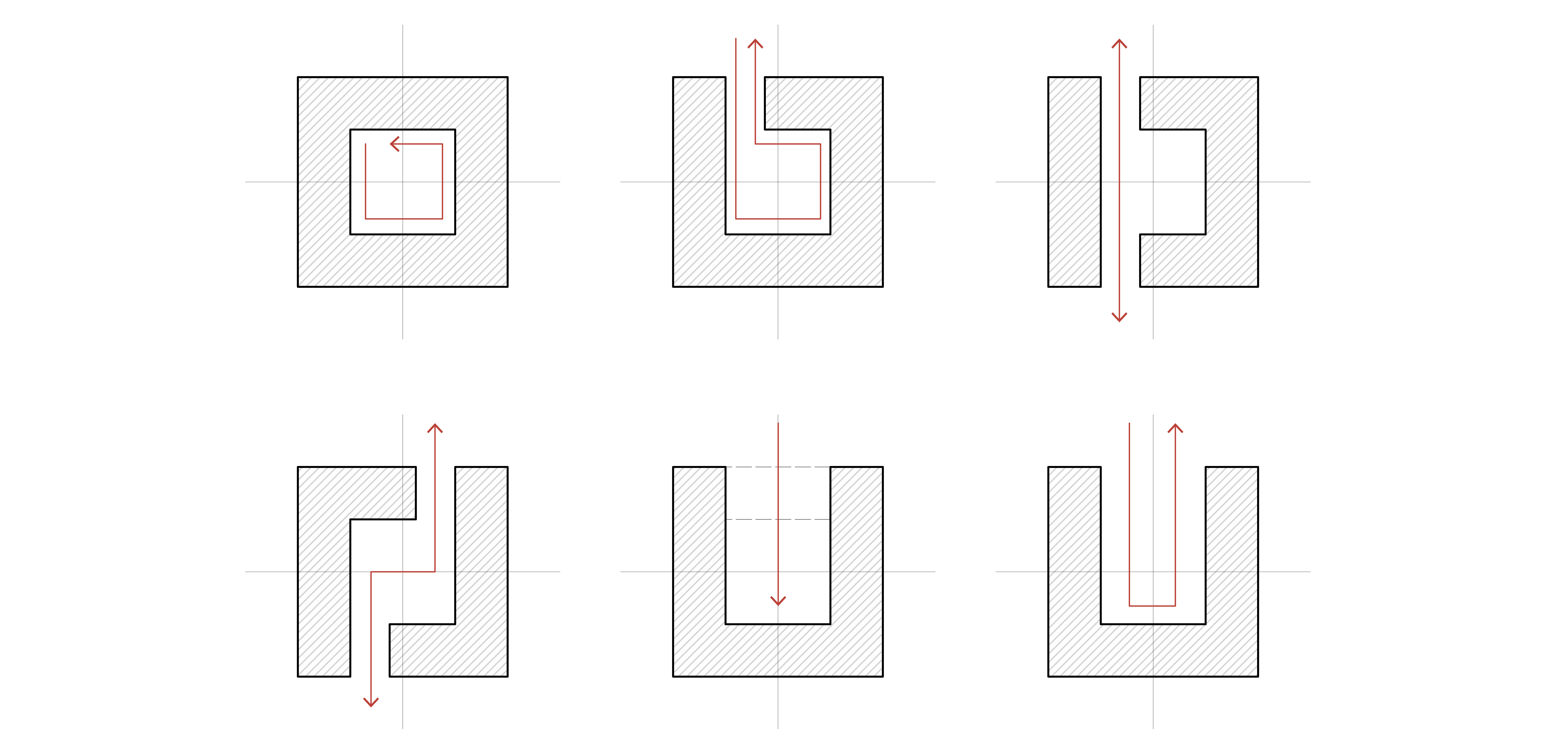
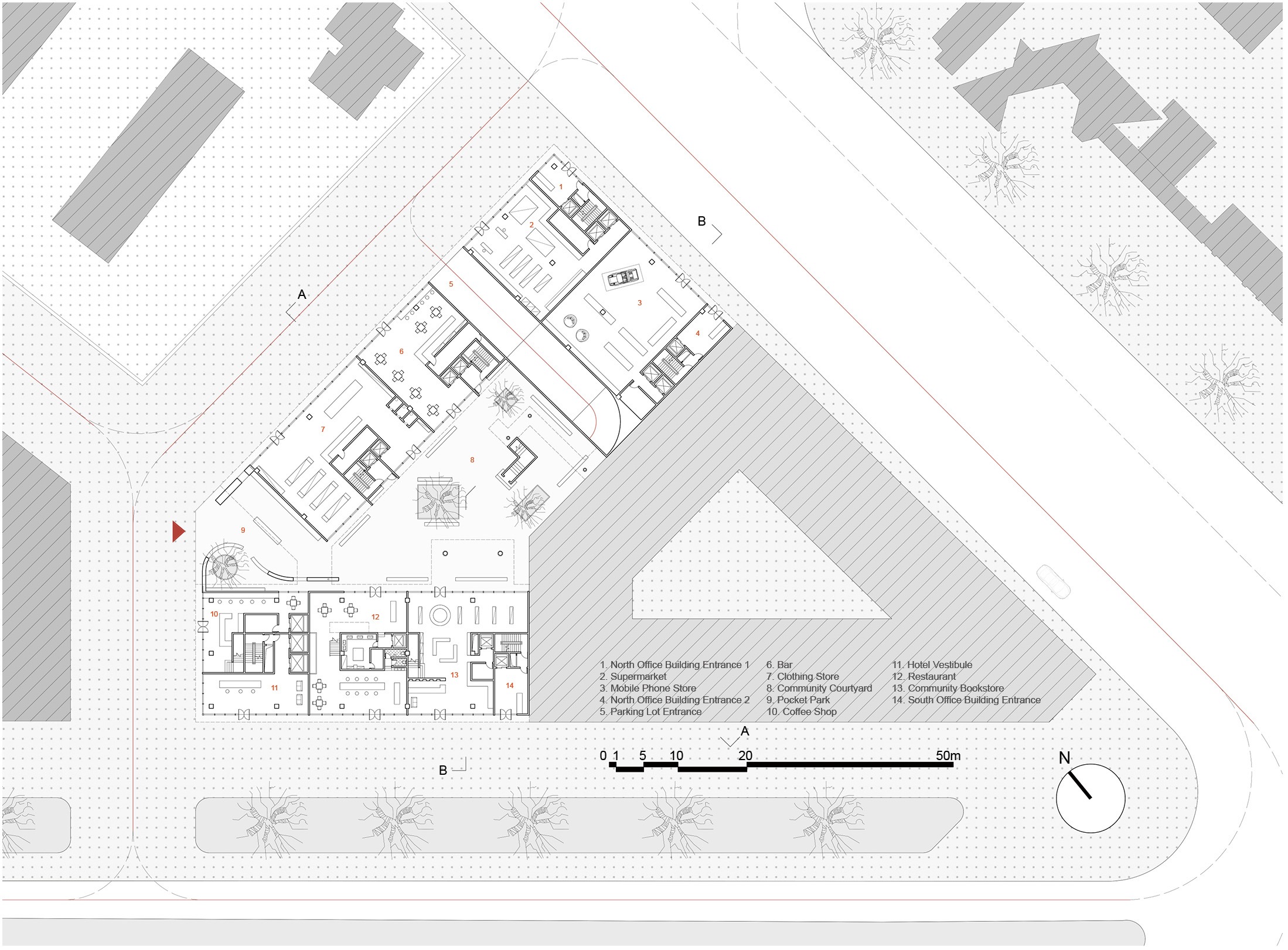
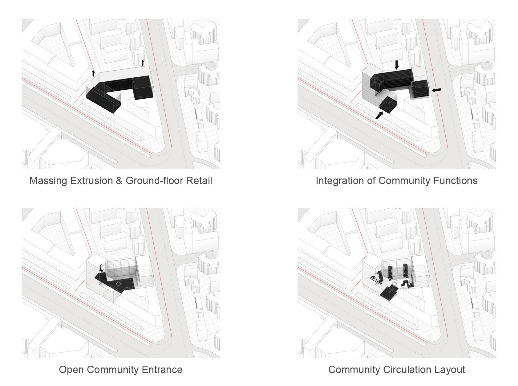
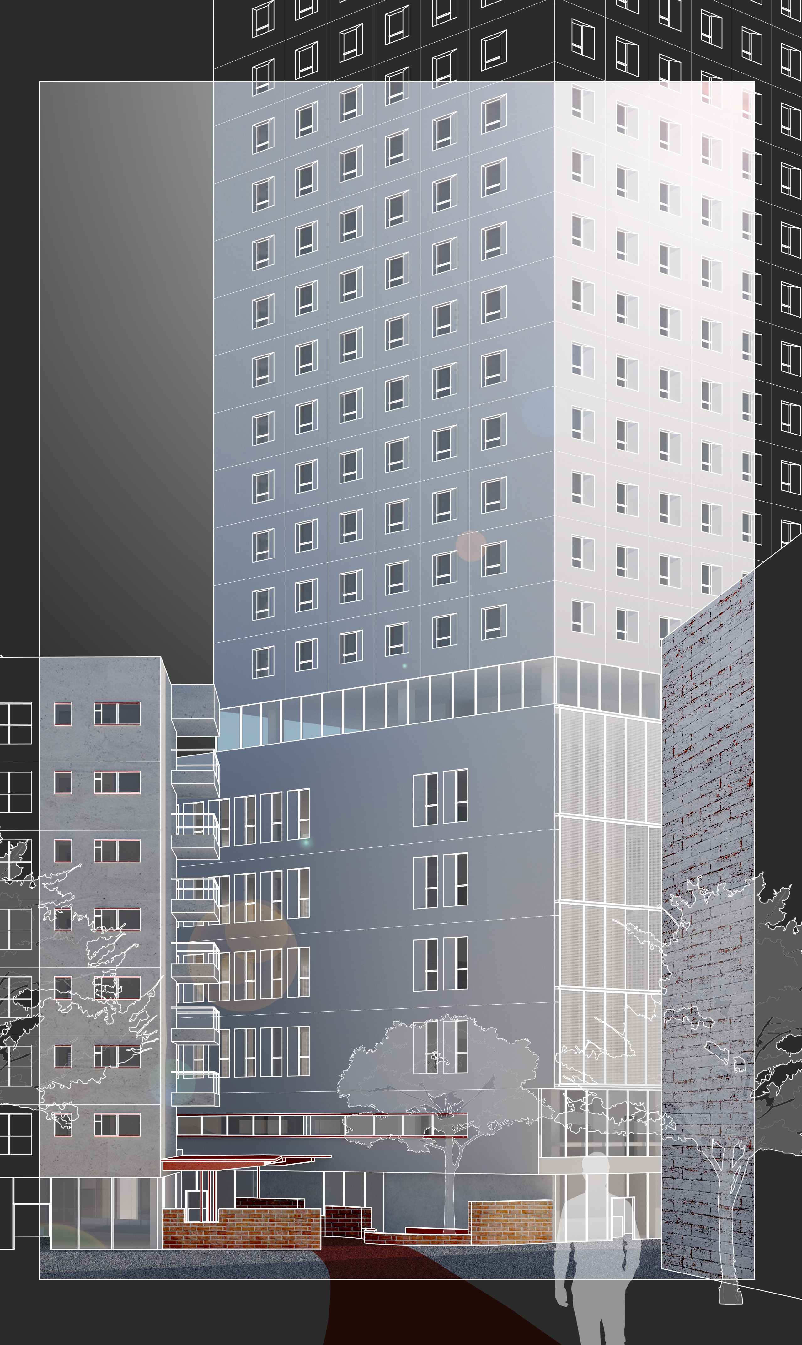
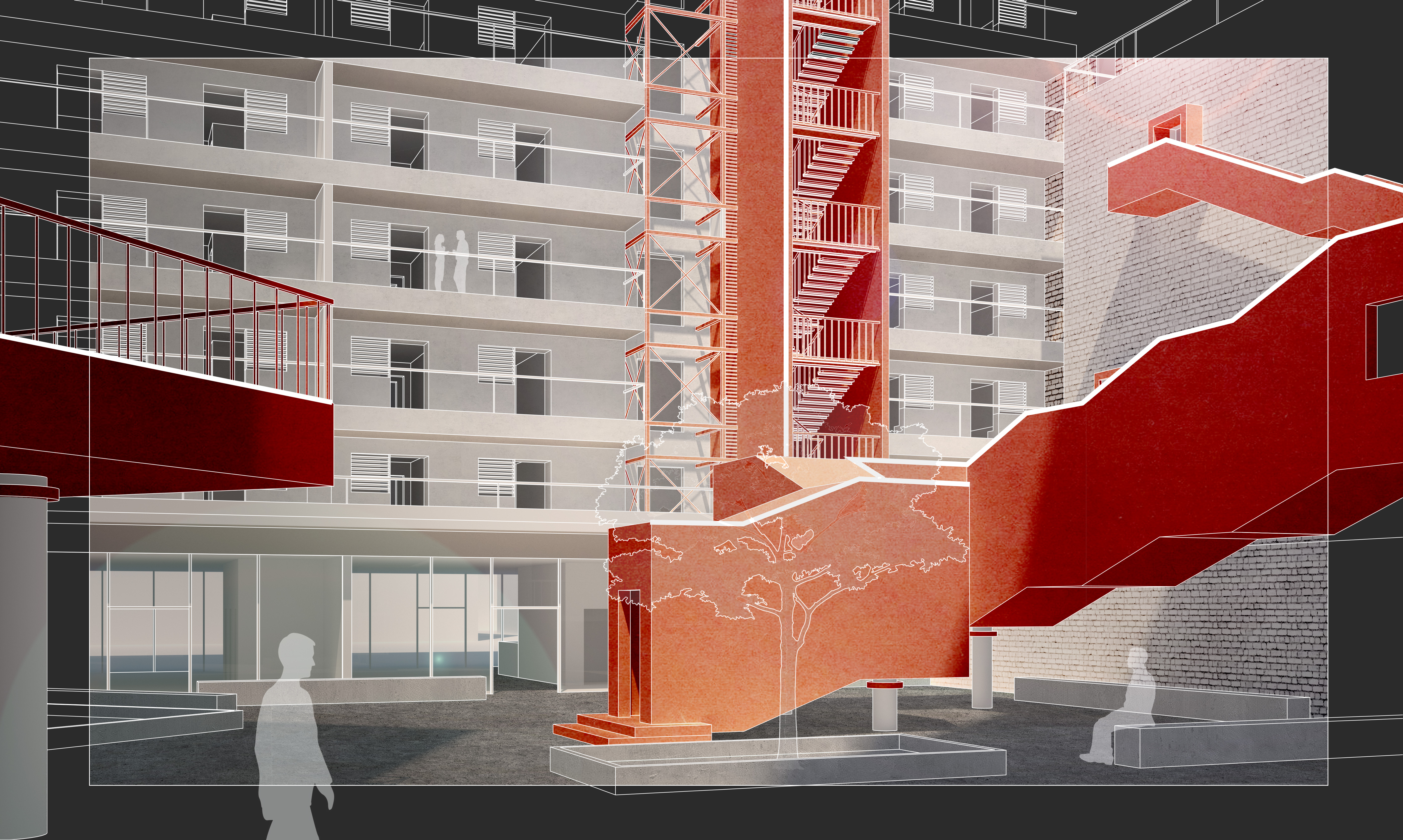
The project re-subdivides parcels along Century Avenue, gradually consolidating a 'small blocks, dense street network' structure while resolving chaotic corner intersections. By re-parceling and reactivating the sawtooth-shaped green spaces, it forms enclosed block-based building clusters that effectively define Century Avenue’s street frontage. Through the integration of ground-floor retail and careful consideration of the urban façade, it creates a more suitable street-level public realm. Meanwhile, by interweaving community modules and adopting an open, porous layout, it generates a rich sequence of inner courtyards—thereby establishing a complete and legible hierarchy of public spaces.

Block and Parcel Scale Study
Given the lack of research and clear delineation of parcel scale at the urban design level in Chinese cities, I selected exemplary urban design precedents based on the specific characteristics of Century Avenue. In parallel, by analyzing courtyard typologies of enclosed mixed-use developments, I established a building layout approach suited to the site—thereby structuring a multi-layered public-space system that ranges from street-level spaces to inner-courtyard community spaces.
Existing Base Map of Century Avenue
The existing parcel conditions along Century Avenue clearly reveal a disordered road system, inefficient corner intersections, an uncontained and poorly defined street frontage, and irregular, unstructured block and parcel subdivision.
Parcel Subdivision and Road Network Adjustments
The road network was reconfigured and optimized to establish a multi-tier street hierarchy. By subdividing oversized parcels into smaller ones, the building massing was scaled more appropriately, street edges were better defined, and corner traffic performance was improved.
Building Outline after Renovation
After obtaining the newly subdivided small-scale plots, we consolidated several parcels to align with the development intensity along the new city's main arterial roads. By employing a perimeter block typology, we defined the street edges and urban space while simultaneously creating private internal courtyards. The architectural design scope of this project is indicated by the red-shaded volumes.
Courtyard Typologies
Ground Floor Plan
Ground Floor Plan
Design Process
Design Process
figure
figure
Community Node Functions and Circulation Analysis
figure
Section A-A
Section A-A
Section B-B
Section B-B
figure
Unfolded Elevation
Unfolded Elevation
figure