Dwelling the Flowing Slope

Dwelling the Flowing Slope

Karlovo Living Landscape Competition 2026
Team Work
Residential & Commercial District
Site: Banská Bystrica, Slovakia
Area: 48000m²
2026.02-2026.03

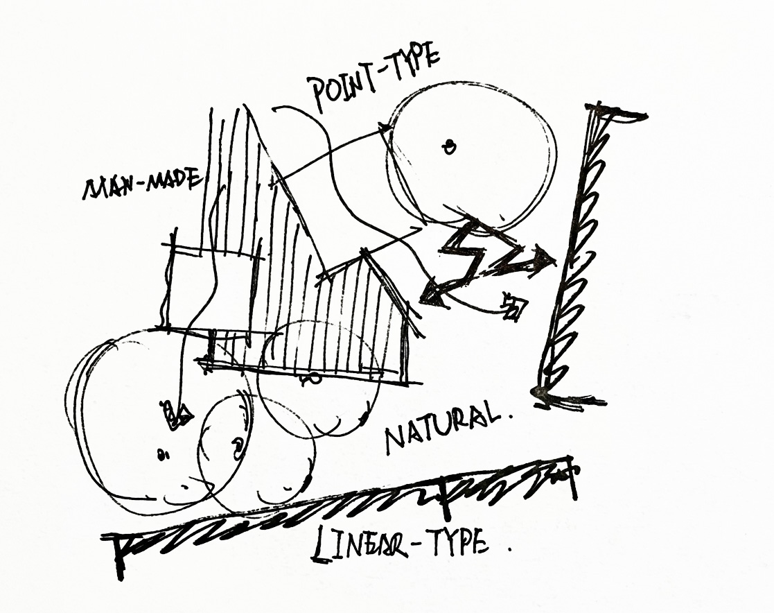
The proposal draws on the site’s vernacular architectural language and landscape setting, translating the local duality of linear street-edge housing and dispersed pitched-roof hillside settlements into a contemporary framework. Rather than replicating historical forms, the design establishes a dialogue between civic and intimate spaces, linear order and porous landscape, while reinforcing a clear sense of community structure.

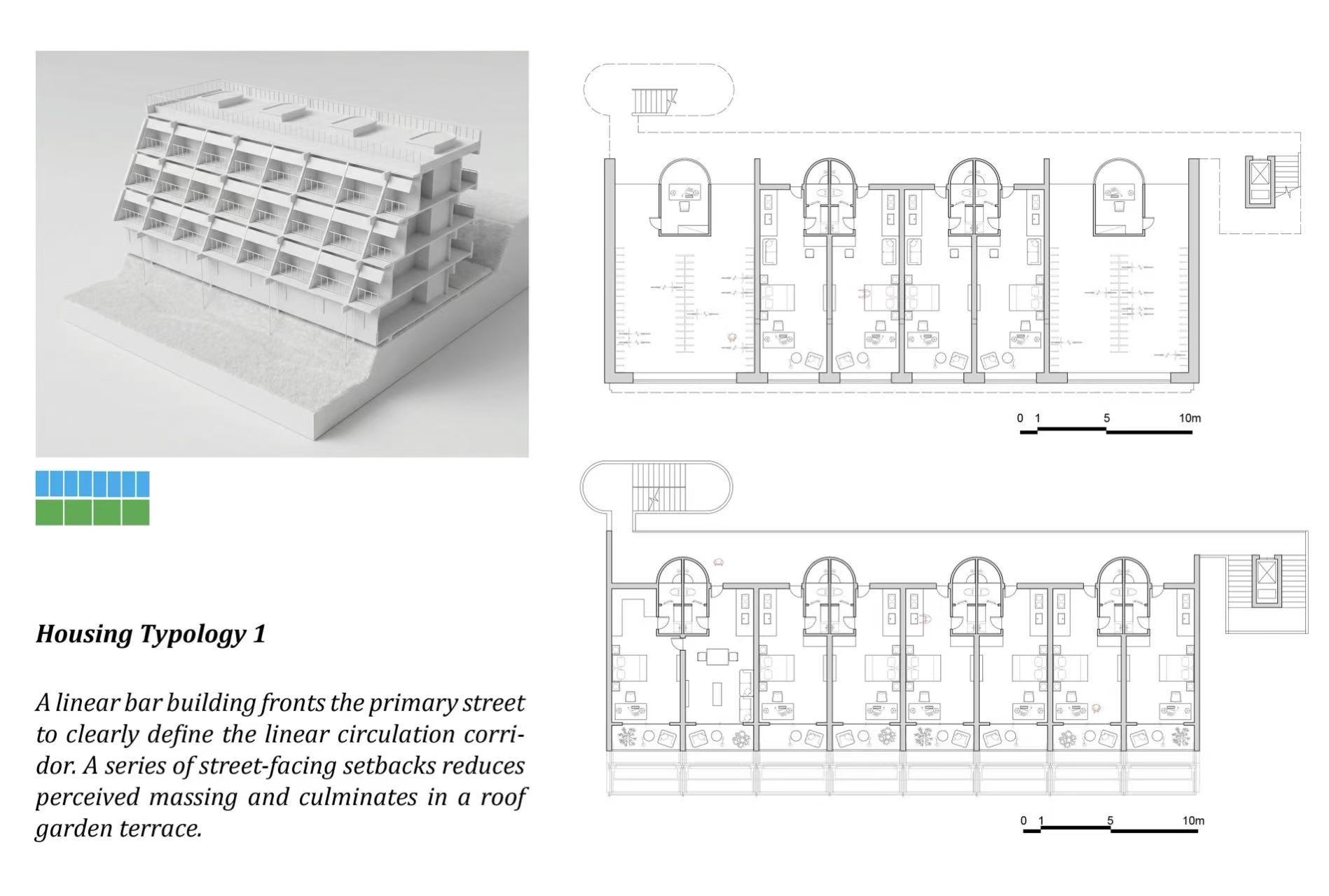
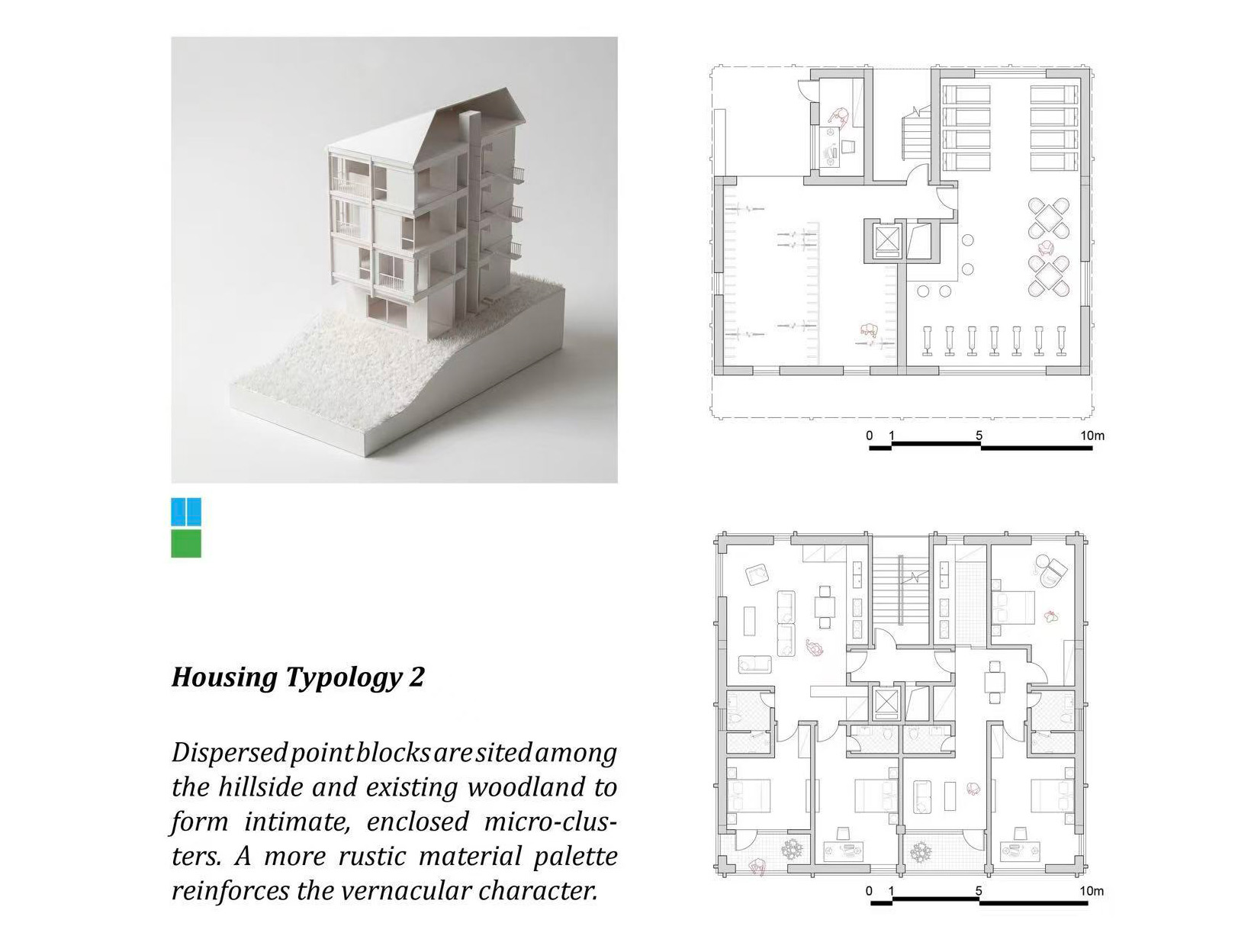
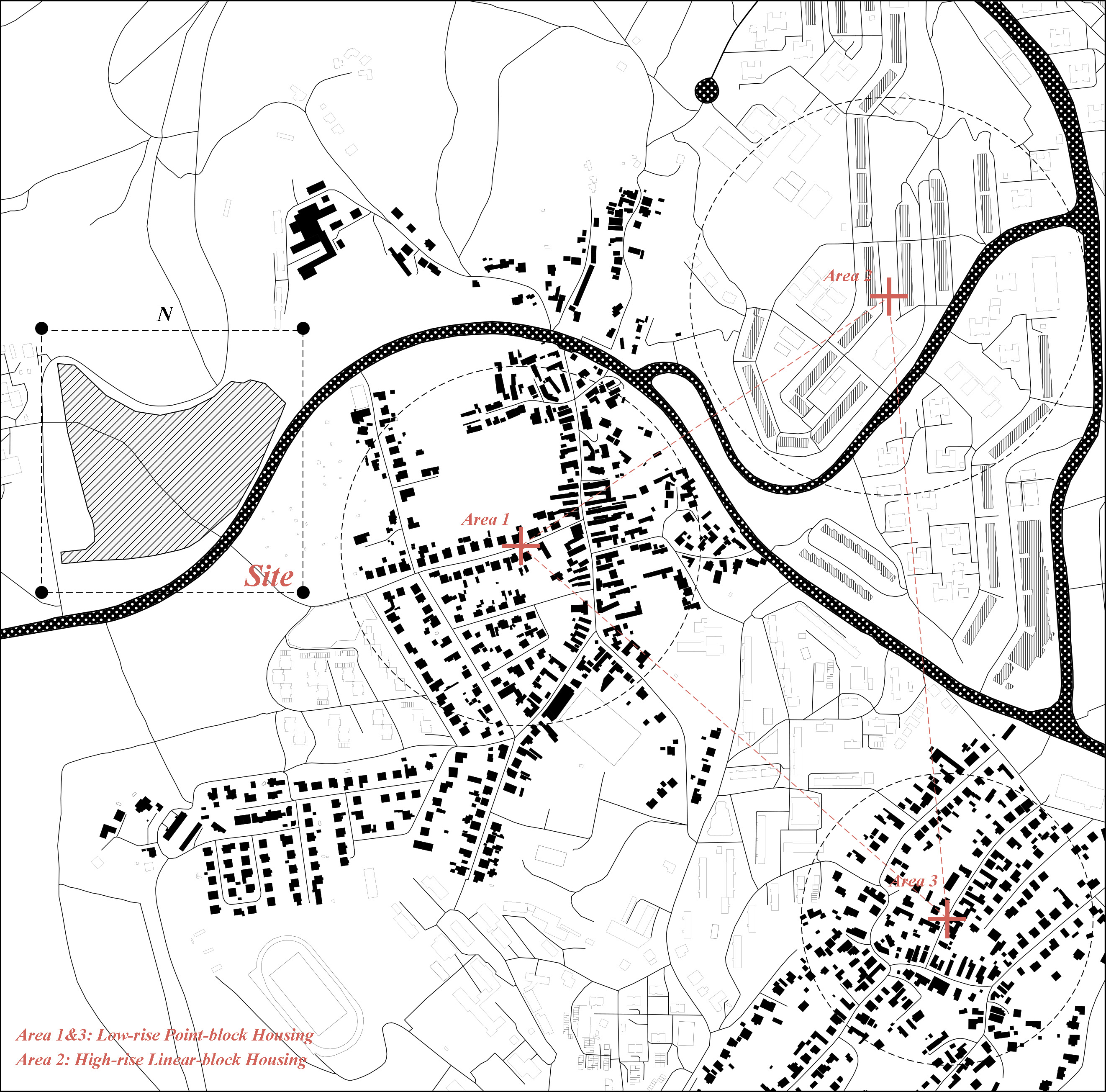
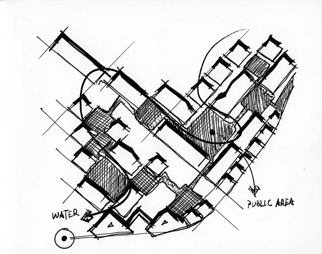
The masterplan is organized through a clear development gradient, with the highest density and most public programs along the urban road, gradually decreasing toward the hilltop and forest interior. This strategy responds to sunlight, views, and privacy while defining a sequence from public to private space. Two housing typologies support this logic: bar-shaped blocks activate the street edge and provide terraced communal spaces, while smaller point-block clusters are embedded higher on the slope, creating more private communities closely tied to the landscape.

A consistent material and infrastructural strategy unifies the scheme. Masonry plinths anchor the buildings to the ground, timber superstructures lighten the volumes and age naturally, and steel is used selectively in circulation elements requiring slenderness and durability. Rainwater is treated as both a resource and a spatial generator through visible harvesting and drainage landscapes, while a continuous slow-mobility network of promenades, ramps, boardwalks, and paths connects the site, linking public commons, residential clusters, and private gardens into a coherent and resilient neighborhood framework.
Site Building Typologies and Urban Structure
Sketch 1
Sketch 2
Waterscape Design and Community Courtyards
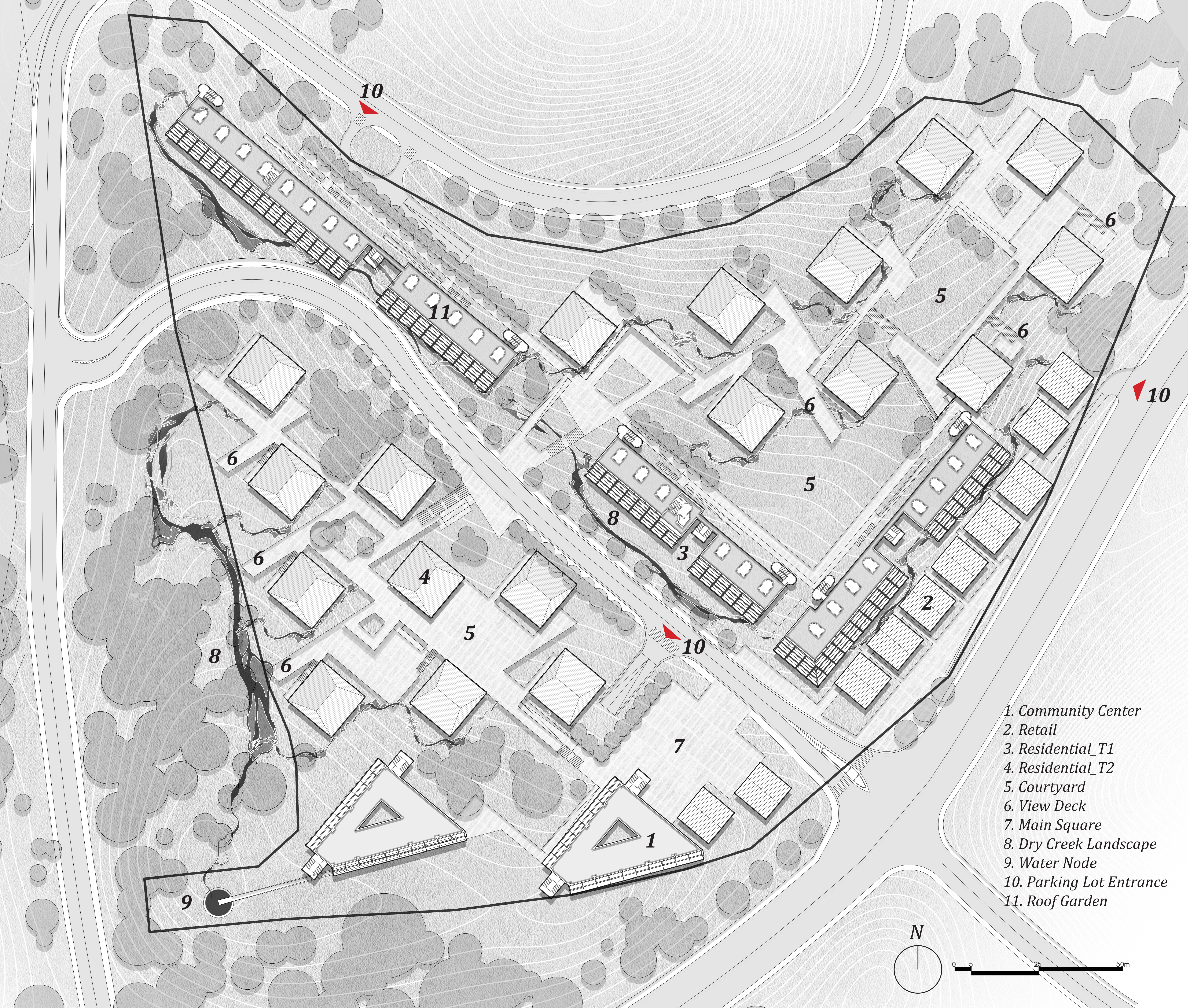
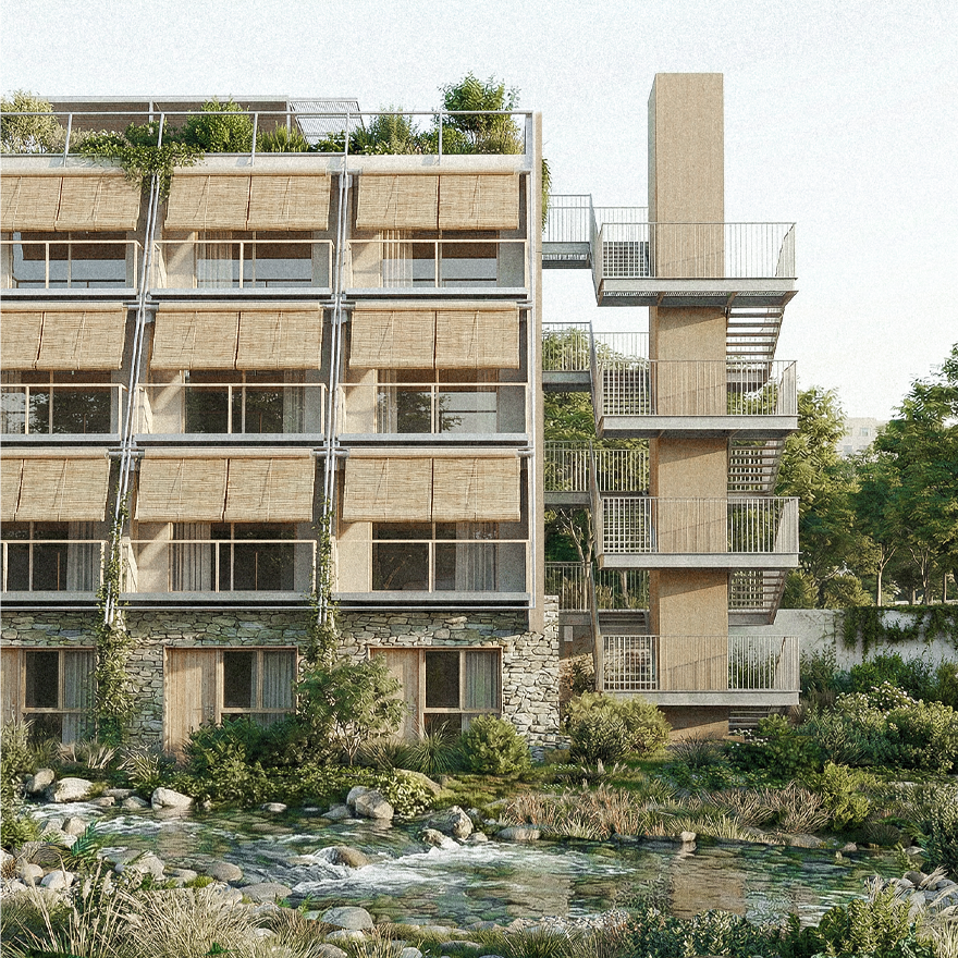
The master plan introduces community courtyards at multiple scales, creating diverse shared platforms and activity spaces within a regular urban fabric. Integrated with topography, the rainwater system forms a dry creek landscape that, together with the architecture, shapes comfortable residential spaces that age gracefully.
Masterplan
Masterplan
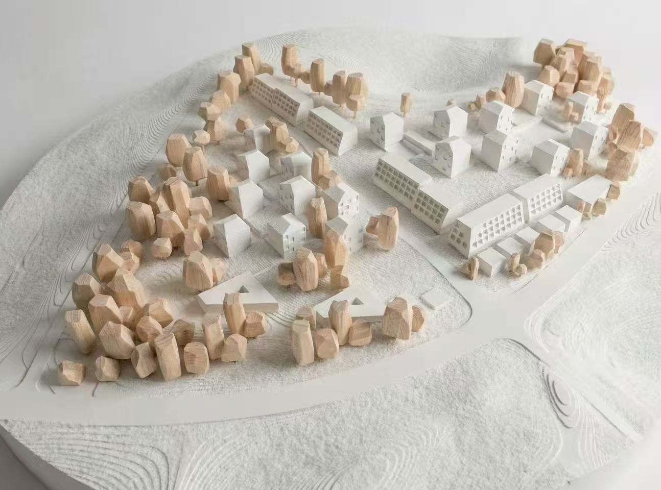
Aerial Model
Aerial Model
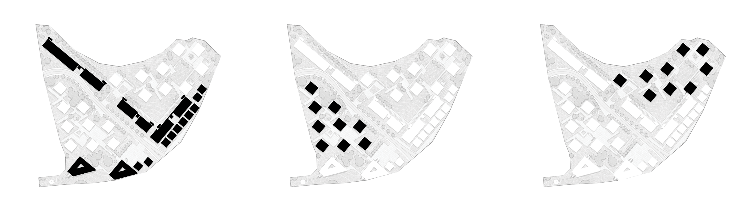
The master plan is organized into three phases of development. The first introduces the linear housing blocks, which define the edges along both the main street and the internal streets, create terraced spatial layers, and effectively structure the site. The point buildings near the top of the slope enclose an internal community space with a stronger degree of designed intervention, while the area between them and the linear blocks retains more of the original green landscape. To the south, the point buildings are more deeply embedded within the forest, forming a more private communal environment.
figure
figure
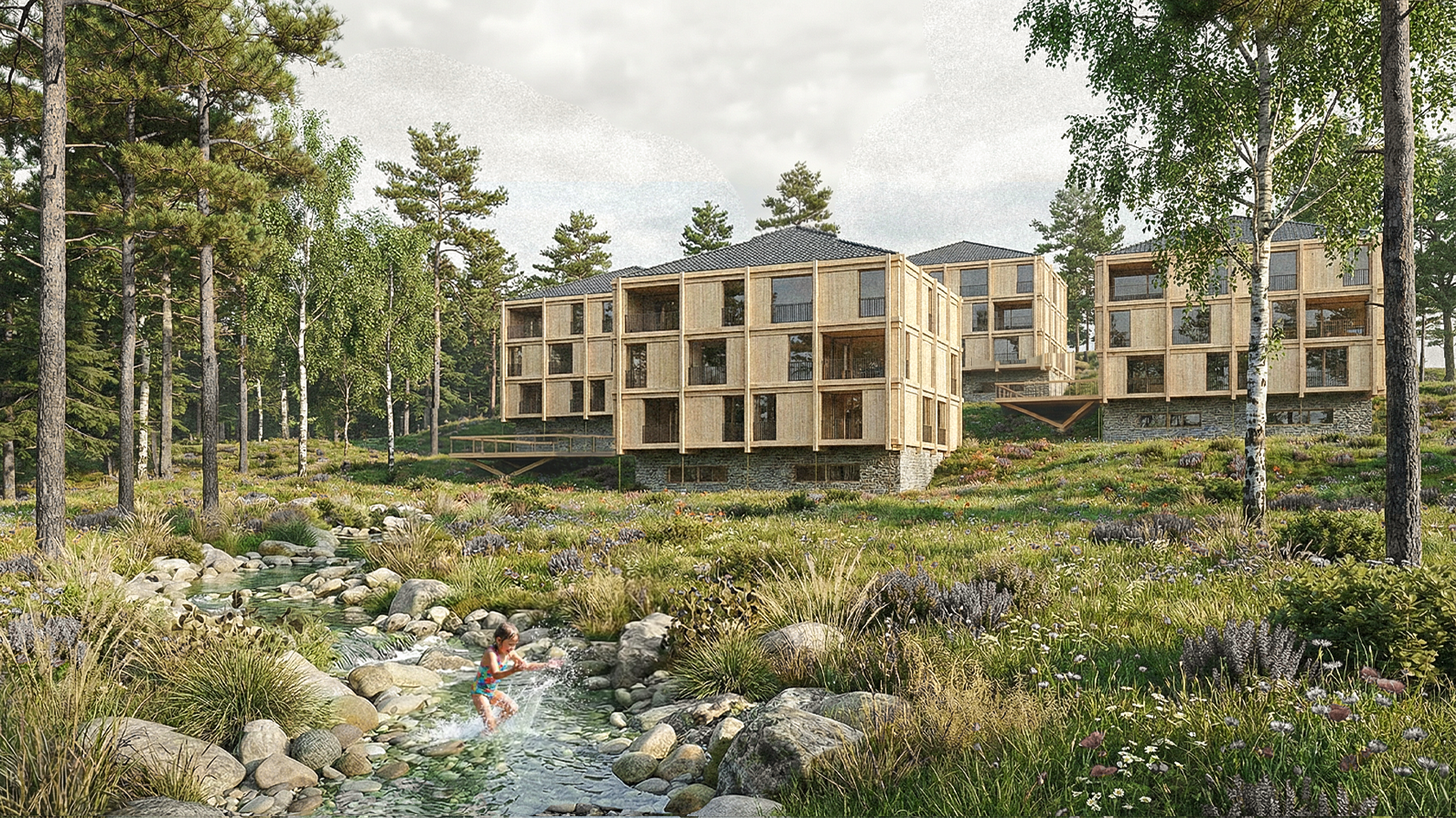
Facade of the Linear Housing and Dry Creek Landscape
Facade of the Linear Housing and Dry Creek Landscape (Generated by AI)
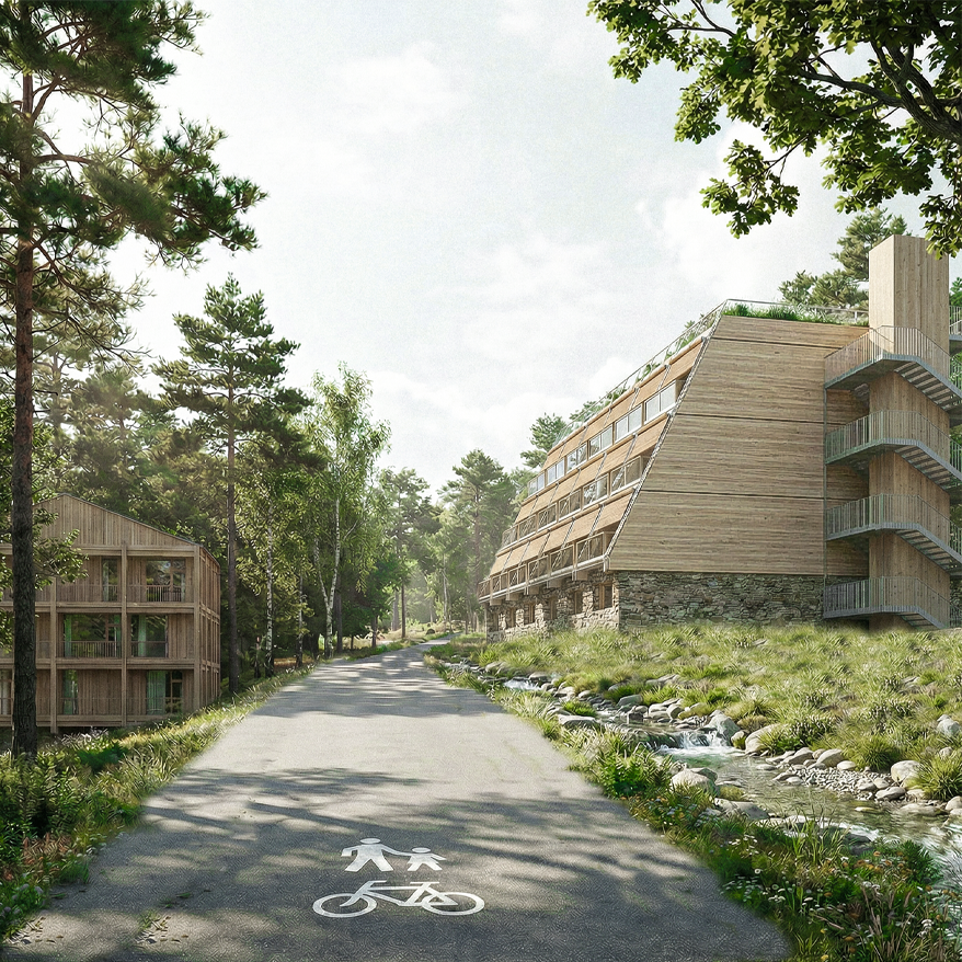
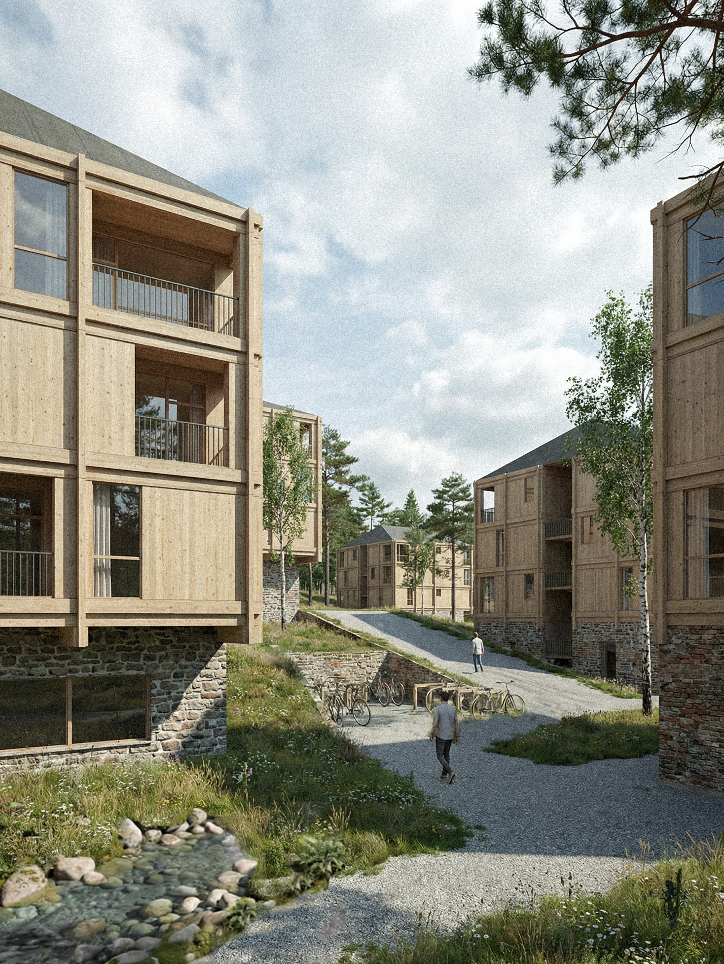
Pedestrian View from the Internal Street
Pedestrian View from the Internal Street (Generated by AI)
Long Section
Long Section
Visualizing the water-flow network and its coupling with topography and built form, together with the slow-mobility circulation and the organization of residential clusters.
Construction Phases
Construction Phases
Prioritize the public buildings and bar-building blocks in Phase 1 to activate the frontage and generate early revenue. Phase 2 and 3 then deliver the point-block housing on both sides of the road in sequence.
Courtyard Enclosed by Point-Block Housing (Generated by AI)